Gothenburg Maps and Orientation
(Gothenburg, Vastergotland, Vastra Gotaland County, Sweden)
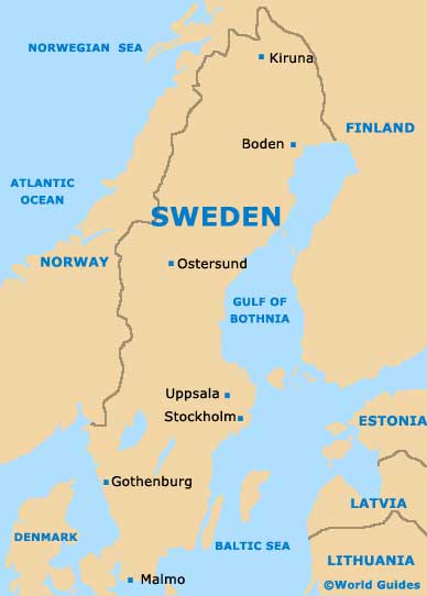
Situated on the westerly shoreline of Sweden and within the region known as the Västra Gotaland County, the Swedish city of Gothenburg is currently the country's second-biggest city. Gothenburg is a large and prosperous city, and now has a population of more than half a million inhabitants.
The very heart of Gothenburg is intersected by the Avenyn (Kungsportsavenyn), which actually crosses over one of the city's remaining historic canals. This prominent thoroughfare leads all the way to the Götaplatsen and is lined with charming boutiques, pavement cafes and theatres. Nearby and in this part of Gothenburg you will find the busy central train station, and also the bustling Nordstan shopping centre, where an excellent selection of shops await.
Maps and Orientation of the City
Gothenburg's many former shipyards are concentrated around the northerly island of Hisingen, which is easy to reach by car or bus and connected by the Alvsborgs Bridge. Hisingen can also be accessed by using the E6 motorway and its tunnel. The E6 motorway also provides a fast way to travel between Gothenburg and both
Malmo and
Oslo.
- Ale - 34 km / 21 miles (35 minutes, north-east)
- Ambjörnhagen - 19 km / 12 miles (22 minutes, south)
- Asperö - 11 km / 7 miles (15 minutes, south-west)
- Harryda - 24 km / 15 miles (25 minutes, east)
- Kungälv - 21 km / 13 miles (22 minutes, north)
- Kungsbacka - 27 km / 17 miles (30 minutes, south)
- Larsered - 13 km / 8 miles (15 minutes, north)
- Lerum - 22 km / 14 miles (22 minutes, north-east)
- Mölndal - 6 km / 4 miles (10 minutes, south)
- Partille - 10 km / 6 miles (11 minutes, north-east)
- Stigberget - 5 km / 3 miles (5 minutes, west)
- Timmervik - 42 km / 26 miles (40 minutes, north-west)
Map of Sweden
Map of Gothenburg

